
Umum |
|
| Dimensi | 14.1″ x 8.9″ x 2.7″ (35.8 x 22.6 x 6.9 mm) |
| BERAT | 5.2 lbs. (2.34 kg) |
| Tahan air | IPX7 |
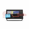
| TIPE layar | WXGA display |
| UKURAN LAYAR | 10.3″ x 6.4″; 12.1″ diagonal(26.2 x 16.3 cm; 30.7 cm diagonal) |
| RESOLUSI LAYAR | 1280 x 800 pixels |
| Opsi Pemasangan | Gantung atau benam |
Peta & Memori |
|
| Menerima Kartu Data | 2 SD™ cards |
| Rute Navigasi | 100 |
Sensor |
|
| Receiver Hz | 10 Hz high-sensitivity |
| Kompatibel dengan NMEA 2000 | Ya |
| Kompatibel dengan NMEA 0183 | Ya |
Fitur Chartplotter |
|
| Kompatibel dengan Mode Pintar | Ya |
| SIA | Ya |
| DSC | Ya |
| Mendukung Radio yang Kompatibel dengan Fusion Lync | Ya |
| Dukungan Sonar Kotak Hitam GSD | Ya |
| Dukungan Sonar Kotak Hitam GCV | Ya |
| Kompatibel dengan GRID (Perangkat Masukan Jarak Jauh Garmin) | Ya |
| Remote Nirkabel Kompatibel | Ya |
Koneksi |
|
| Koneksi Port Input NMEA0183 | 1 |
| Port input video | 1 BNC |
| Port output video | Tidak |
| Koneksi Port Jaringan Laut Garmin | 2 |
Physical & Performance |
|
| Physical dimensions | 14.1″ x 8.9″ x 2.7″ (35.8 x 22.6 x 6.9 cm) |
| Display size, WxH | 10.3″ x 6.4″ (26.2 x 16.3 cm) |
| Display resolution, WxH | 1280 x 800 pixels |
| Display type | WSVGA display |
| Weight | 5.2 lbs. (2.34 kg) |
| Antenna | External BNC or external over NMEA 2000 |
| NMEA 2000® compatible | |
| NMEA 0183 compatible | |
| Power consumption | Max power usage at 12 Vdc: 43.2 W Typical current draw at 12 Vdc: 2.2 A Max current draw at 12 Vdc: 3.6 A |
| Mounting options | Bail or flush |
| Garmin Marine Network™ | |
Maps & Memory |
|
| Preloaded maps | Worldwide Basemap |
| Accepts data cards | 2 SD™ cards |
| Waypoints | 30,000 |
| Routes | 200 |
| Track log | 50,000 points; 50 saved tracks |
Chartplotter Features |
|
| Garmin Radar compatible | |
| Garmin Sonar compatible | |
| Supports AIS (tracks target ships position) | |
| Supports DSC (displays position data from DSC-capable VHF radio) | |
| Tide tables | |
| GSD™ Black Box sonar support | |
| GCV™ Black Box sonar support | |
| GRID™ (Garmin Remote Input Device) compatible | |
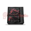
Sonar Features & Specifications |
|
| Dual-frequency (50/200 kHz) sonar capable | |
| Dual-beam (77/200 kHz) sonar capable | |
| Frequencies supported | Traditional: 50/200, 77/200 kHz Single Channel CHIRP: 40 to 240 kHz Garmin ClearVü CHIRP: 260/455/800 kHz (dependent on transducer) |
| Transmit power (RMS) |
Traditional 50/200 kHz sonar: 2 kW 77/200 kHz sonar: Max 500W CHIRP high/mid/low bands : Max 1kW Garmin ClearVü CHIRP: Max 500 W (dependent on transducer) |
| CHIRP sonar technology | |
| ClearVü | |
| Maximum depth | 5,000 ft at 2kW (depth capacity is dependent on water bottom type and other water conditions) |
| Bottom lock (shows return from the bottom up) | |
| Water temperature log and graph | |
| Sonar recording | |
| Sonar history rewind | |
Connections |
|
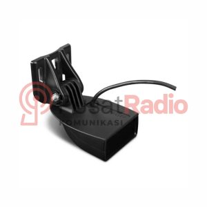
| Transducer pin numbers | 8 |
| NMEA 0183 compatible ports | 2 |
| Video input/output | |
Reviews
There are no reviews yet.